Feeds:
Posts
Comments

Posts Tagged ‘black hill’

It’s all coming back to me now. This time last year I’d done a considerable amount of running in preparation for the New Chew 2012 before falling down a hole in the paving slabs on the Pennine Way on Black Hill. This year I did little. I’d done a fair bit over Christmas in preparation for the Trigger (Marsden to Edale Fell Race) on January 13th but since then had only run twice and one of them was along Blackpool prom – hardly a fell.

It wasn’t until I was driving to the race with my good pal and team mate Dr Ali that I began to think about the facts – we’ll be out running on t’moor for four and a half hours that’s  30 minutes less than it took us to do the Trigger… erm…oh ‘eck I hadn’t thought of that. To be honest I hadn’t thought about anything since booking us on the race – well I don’t do I?  “Never mind I was OK last year” I told myself as I tried to plant a false memory of effortlessly gliding across hill and dale 12 months earlier.

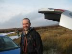
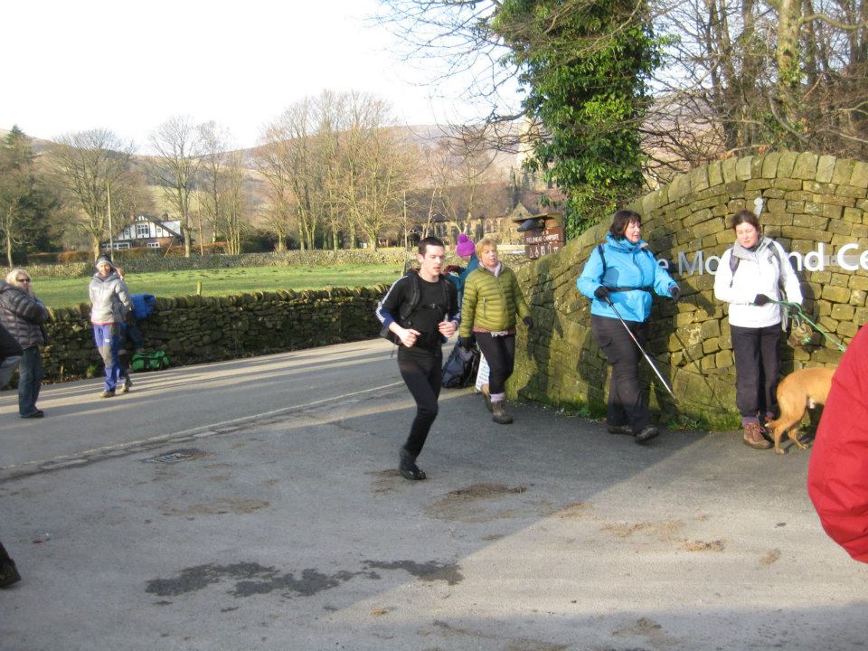
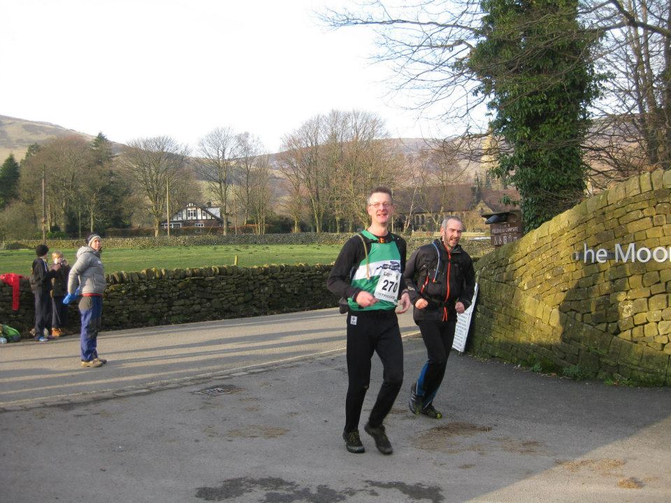
We were soon parked and heading for kit check and registration at Dovestones Sailing Club. One of the things I find quite wonderful about fell races is the genuine joy, energy and helpfulness of the people on the organising teams.  The Saddleworth Runners are no exception. I have never before been greeted by so many friendly smiling faces on such a cold, wintry morning – and can’t imagine Simon Pymm on kit check being happier if he’d run and won the race.

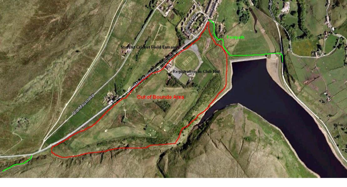
With kit checked and numbers pinned to clothing we waited in line to start. We got our maps and start time at 9:52am and we were off. Dr Ali was quickly at work studying the map and planning a route – he’s bloody good at this and quick. After some discussion we had a strategy. We decided to head up the Chew Valley and out towards Holme Moss and Crowden where the big points were – doing the Trigger a month earlier had given us a good indication of the ground we could cover and how long it would take. We could then head round to Black Hill and head back over Saddleworth Moor. It was a good plan and gave us room for manoeuvre should we need to make adjustments.

Eh? So how does it work?

This kind of race has no fixed course or route and is as much about navigation as speed. At the start of the race your are given a map of the area covered and a control card. Dotted around the area are control points each with a unique number or stamp with which you mark your control card. Each control is worth a number of points dependent on the relative difficulty of getting to it. The location of the controls are shown on the map. The idea is to get as many points as you can within the given time – in this case 4 hours 30 minutes. For each minute late you lose 3 points.

So how did it go?

It was cold. The run up Chew Road got us into a good rhythm and quickly warmed us up. Our first control (5 points) was just off the track on the top of a knoll. We bagged this and carried on up to Chew reservoir where we found the second control and a photographer. We got another 10 points for the control but nothing for the photographer. Here the weather turned almost arctic so we kept moving. We set a good pace heading east to find the Pennine Way where we descended into a glorious spring morning. Our third control was a bit trickier to find being located at the bottom of a crag (Rakes Rocks) which we couldn’t see because we were running in a trough. Rising onto higher ground we were soon able to find it for 20 more points.

From here we planned to head up the Pennine way, about a mile past Laddow for the next control. We decided to miss this one and instead head straight down into Crowden Great Brook (15 points) then back up into the arctic winter, across Bareholme Moss to the grouse butts in Wiggin Clough. This control was labeled as a sheep fold but turned out to be a grouse butt. No matter, we found it easily (30 points) and made jokes about small sheep whilst looking at a group of people scratching their heads at the sheepfold near the grouse butts about 200 metres further north.

Another change of plan at this point. We decided to cross Crowden Little Brook and head south to pick up a 35 point control on a slag heap in a disused quarry just above Crowden before heading back north to Stonefold Grough on Westend Moss for another 30 points. Somewhere along this route we had to ditch our plan for getting to the control on Holme Moss calculating that the descent to Heyden Brook and up the other side would take us too long. We headed straight up to Black Hill making good time on decent terrain.

Dr Ali’s expert navigation and route finding saw us arriving at the A635 – Isle of Skye Road – in Peak Bog Men record breaking time. We crossed the road to the layby and located our next 20 points. With about 50 minutes remaining it felt like we  were cutting it fine but should get back in time… so, perfect then. We crossed the road and soon found the next control at a stream junction (15 points) before following the stream to Rimmen Cottage – the old shooting lodge for our final 10 points.

Points in the bag all that was left was a long slog back to the finish at Dovestones Sailing Club. We took the direct route across moorland to Greenfield reservoir- where the steep decent of Ox Rake Brow just about saw off the rest of my legs with about 3 miles of flat trail to go. Dr Ali set the pace so I locked into a rhythm, switched of my head and followed.  We made it back with 4 minutes to spare. Job well done.

We did about 16.5 miles and over 3000 feet of climb – pleased with that.
We came 7th out of 36 in our race (long score) – well chuffed, I think that’s our best yet.
We had a fantastic day – the most important thing.

The Food

The post race food of the New Chew is about as good as it gets. Veg and cheese bake or meat and potato pie – the proper, home made stuff with lashings of  beetroot and red cabbage, none of your nonsense. A variety of expertly made cakes and gallons of tea finishes off a remarkable race with a warm cozy glow.

The New Chew has got to be one of the best races on the calendar. It’s got the lot: great organisation; challenging and varied terrain; weather conditions that vary minute to minute from spring running in t-shirt and shorts to arctic survival in full winter kit; breath-taking scenery;  the spread and variation of controls means that you’re not following crowds around – you hardly know you’re on a race;  and and the food… mmmmm the food. With numbers limited to protect the moorland restoration work I’ll be looking out for registration early next year to make sure I don’t miss out.

Read Full Post »

trigger

Traversing some of the toughest terrain in the Peak District in mid winter, the Trigger Race is a test of speed, navigation and endurance and often – in my case -survival. Starting at Marsden the route measures 20 miles as the crow flies and ascends over 4500 feet climbing Black Hill, Bleaklow and Kinder before finishing in Edale. Profits from the race are donated to the Woodhead Mountain Rescue Team.

Totally out of character for me, I’d left entry too late and failed to get on the starting list. I had made it on to the reserve list though, and a couple of Peak Bog Men had bumped into the race organiser whilst doing a reci on Bleaklow who’d told them I would get a starting place. I was going to do it anyway – jumping into the race at the start and tagging along unofficially  As it turned out there was no need. A couple of weeks later I learned I was in – Entry List. Plans for anarchic fell running were wisely dropped.

Not knowing the route beyond Crowden I was planning to stick to the Pennine Way and other major footpaths as much as possible. An hour studying maps with Dr Ali who’d done the race before and surveyed much of the route changed my mind – so I think I’m already on Plan ‘C’.

Logistics were sorted out, cars were taken and left at Edale to get us home and support from ‘Jellied Eels’ Jeff Button was organised.

The weather in the week leading up to the race had been utterly miserable so I was pleasantly surprised to wake and find glorious sunshine and, importantly, no wind whatsoever.

Alistair Macdonald, Rick Legge, Alistair Macdonald, Stephen Fraser, Steven Tuck

Alistair Macdonald, Rick Legge, Alistair Macdonald, Stephen Fraser, Steven Tuck

We met at Marsden Cricket Club and after the usual formalities and photographs we were off. I’d anticipated a bit of a bottleneck going through the gates approaching Butterlley dam so made sure I got myself forward for the start. It quickly became apparent that, though the start route had been published nobody had actually studied it. This lead to what has been termed the Keystone Cops start to the race and a good deal of hilarity  Calls of “which way do we go?” and “We’re all following you” were shouted – I even heard someone say “Follow Mr Tuckle”, I can only guess they sensed that I had some local knowledge. Going through the first gate I found myself in first place! Pity it was at the wrong end of the race and for only 5 seconds. A group passed me then turned to ask me which way they should go when we reached the next gate. It was good to see Mac cheering us on as we crossed the Dam but sadly he was unable to prevent the tidal wave of runners now passing as we hit the obvious trail up the Wessenden Valley.

I quickly found my pace and settled in for the long haul as many, many runners passed me by. I was surprised to see people walking where the route steepened briefly at both Little Hey Sike and Leyzing Cloughs and managed to gain a few of the places I had lost. At Wessenden Head reservoir We came off the main Wessenden trail and got our first taste of boggy, tussocky moorland following the ‘Old’ Pennine Way route up to the first road crossing A635 – known locally as the Isle of Skye Road after the pub which was here up until the 1950s when it was demolished either due to a fire or the potential health threat from drainage into the reservoirs.

Crossing the road we continued the slog up Black Hill on paving slabs. Straight forward enough but great care had to be taken descending the steep sides of Reap Hill and Dean Clough as my Mudclaws glided effortlessly across the icy surface Blades of Glory style. I didn’t want to risk a fall here so walked down gingerly. Scanning the path carefully for the holes I am prone to fall down. I was soon at the foot of the steep section on the side of Issue Edge which leads to the summit. Everybody seemed to be walking up this section, I’m pretty sure they all thought I was insane as I slowly edged past them in a low gear. It felt great to get to the top where I gave myself a mental high-5 as I tagged the first trig point of the race.

The mist began to thicken but retained the brightness that betrays better things to come. I turned off the Pennine Way and followed a trod across the edge of Sliddens Moss. Here the ground was perfect – soft with a crisp icy shell. A steep and exciting  decent lead to Crowden Little Brook. Crossing the brook lead to what is probably an old quarry access road – now a rough trail mined with icy puddles every few yards – 3km of this and I would be at the first checkpoint and refreshments with Jeff. Just before the end of this section I saw my first fellow Peak Bog Man as Alistair passed me. This surprised me as I thought he was already ahead of me. Taking the connoisseurs descent route off the hill I was soon with Jeff who had doing a sterling job of organising supplies. I was busy gulping down some of these supplies when we were joined by Dr Ali. I asked Dr Ali if I could tag along with him for the rest of the race as, from here on, I was on virgin territory – I was glad when he agreed. Fresh supplies stuffed into my rucksack and we were off.

We crossed the second road crossing – A628 Woodhead Pass – and followed a footpath around the top of Torside Reservoir where we encountered the first person to offer us Jelly Babies – strange. Crossing the road, we ran alongside a wall before crossing it and beginning the steep ascent which was to lead us to Lawrence Edge. This is where sticking with Dr Ali began to pay off – he know’s these parts. Definitely not runnable this is a scramble. A scramble that has to be undertaken with the sound of gun fire from neighboring gun club echoing around the rocks. It’s worth it though. Height was gained rapidly and we soon found gradient easing off as we headed to Shining Clough Moss on a moonscape beneath a perfect blue sky.

We joined the Pennine Way just south of Far Moss before leaving it for a trod which took us straight to trig point number 2 at Higher Shelf Stones. This last section was like being on another world. The ground, being covered in ice crystals, sparkled and shone in the bright, clear sunlight. This vision and a surge of endorphins triggered a euphoric rush which lasted for a good ten minutes. It was one of the best running experiences I have ever had.

We set off from the trig point on a good trod which petered out near the top of Crooked Clough. Dr Ali’s route finding and research paid off again. We avoided the descending into the Clough and were soon traversing its eastern edge on another good trod which took us to the Pennine Way. On rapidly tiring legs it wasn’t long before we were at our last road crossing – the A57 Snake Pass – where Jeff was waiting with warm tea and Christmas pudding, a treat I’d been looking forward to the whole race. Reaching this point in my mind was ‘job done’ but I hadn’t any idea how much there was left to do.

snake pass snake pass mr tuckle snake pass dr ali

We set off on the Pennine Way which was treacherously icy so I was happy when we left it after about 1km at a delta of streams at the bottom of Withins Clough  which we were to follow on varying trods to the foot of another steep scramble. Time to dig deep and plug away again. We arrived at a group of stones at the top which I later learned from  Bridget were called The Boxing Gloves. After catching our breath we headed off south for our third and final trig point – Kinder. After more jelly babies and a quick bit of banter with the chaps from Woodhead Mountain Rescue we were off on the last stretch.

Not having been on Kinder before I didn’t know what to expect. We headed to the downfall on a  good trod before finding the Pennine Way again. The plan from the downfall was to follow a series of stream systems to the Western side of Grindslow Knoll. Again I felt we were on another planet. Running deep inside groughs and stream beds we were almost permanently surrounded by the darkness of eroded peat – the skyline only momentarily visible when we climbed from one to the other. I struggled to imagine a more difficult place to navigate – Dr Ali told me it involved several compass bearings, a small fir tree and a cairn. Even if I’d possessed the neccersay skill and knowledge I was too tired to use it and was happy I had someone to lead my through this maze of frozen blackness. This section was longer than I had imagined. We eventually found ourselves at the top of Grindsbrook Clough. Dr Ali was cross with himself as this meant we were now on the eastern side of Grindslow Knoll, something he’d wanted to avoid.  He still managed to expertly navigate us on decent paths back to the route which would lead us down into Edale.

edale churchA wave of emotion and relief swept over us as we spotted the steeple of Edale Parish Church which was followed by hearty congratulations and back slapping. I’ve followed Dr Ali around this race twice before in the car and never imagined that I would ever be able to complete such a challenge and here I was finishing it with the person who’d inspired me, and the sun was shining.

We were soon into the village and running down the road to the finish at Fieldhead Campsite where we were greeted by Jeff, Alistair, Rick and Bridget. We came 118th and 119th finishing in a time of 5h 6m 20s. I was elated and knackered but already looking forward to doing again next year.

Finish Line photos by Jeff Button.

rl sf am trigger finish

Read Full Post »

Black Hill is most northerly of the three great gritstone and peat plateaux which dominate the Dark Peak region of the Peak District. Smaller in area and lower than either Kinder or Bleaklow it is nonetheless a remote and bleak place to be in bad weather” – Peak District Information

That said, we are all experienced with map and compass, we know the area very well (and how to get off in bad visibilility), were suited and booted correctly and were carrying a couple of rucksacks full of emergency equipment… Oh and Dr Crowe had his cheroots.

Some fine chaps

Ey up Sharpy, Dr Ali, The Prof and Dr Crowe

We arived in Holme – the start of our walk – slightly late due to a puncture and some misdirection by me. More snow was falling and the Prof and Sharpy were already there waiting for us. After gearing up we set off just before 9pm. With visibilility aided by the snowlight the slog up Issues Road (track) was done without head torches. The row of dead moles pinned to the barbed wire fence like washing on a line made for a slightly eerie sight. I can only assume that this is how the farmers around Holme warn off any other moles thinking of encroaching on their turf.

Things started to get interesting at the end of Issues Road where the snow deepened and the path disapeared under it. After crossing the stream we stopped to check our course but Dr Ali and Sharpy were doing a fine job of navigating and we were soon heading up the steeper section leading to the Pennine Way. With the snow ranging from ankle to almost knee deep my tired legs were soon longing for solid ground. It never came. The snow just got deeper.

Dr Ali’s excellent navigation skills found us at the large cairn which we knew was at the top of the main path before the last summit section. After several false summits we came across two small sticks pushed into the snow which Dr Crowe aptly named the slalom gate.  The chaps who came up here on the New Year’s Day run recognised these as being close to the summit trig point. After 2 attempts to find the trig point from this location we decided that enough was enoough and – not wanting to create so many foot prints so as to confuse our route off – we set off back down.

I was dissapointed to have not found the trig point but soon realised we had made the right decision. The 12 inch deep footprints that we had left in the snow on our way up only 20 minutes earlier had all but disapeared. The snow, so fine and powdery that it felt more like fine sand, coupled with the strong wind and further snow fall had completely covered our tracks. Again Dr Ali, compass in hand, led us expertly and safely past the gulley and down to where we knew we were on safe ground and we soon found ourselves on the trudge down Issues Road and back to the cars completing another fine adventure.

Read Full Post »