
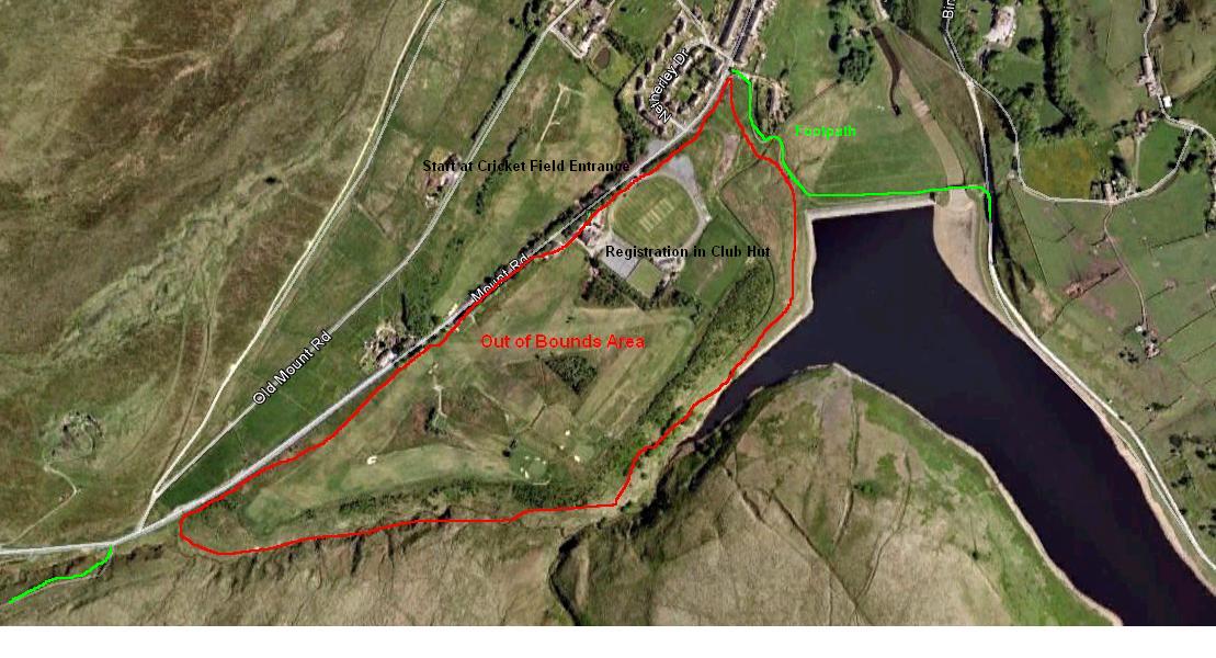
Traversing some of the toughest terrain in the Peak District in mid winter, the Trigger Race is a test of speed, navigation and endurance and often – in my case -survival. Starting at Marsden the route measures 20 miles as the crow flies and ascends over 4500 feet climbing Black Hill, Bleaklow and Kinder before finishing in Edale. Profits from the race are donated to the Woodhead Mountain Rescue Team.
Totally out of character for me, I’d left entry too late and failed to get on the starting list. I had made it on to the reserve list though, and a couple of Peak Bog Men had bumped into the race organiser whilst doing a reci on Bleaklow who’d told them I would get a starting place. I was going to do it anyway – jumping into the race at the start and tagging along unofficially As it turned out there was no need. A couple of weeks later I learned I was in – Entry List. Plans for anarchic fell running were wisely dropped.
Not knowing the route beyond Crowden I was planning to stick to the Pennine Way and other major footpaths as much as possible. An hour studying maps with Dr Ali who’d done the race before and surveyed much of the route changed my mind – so I think I’m already on Plan ‘C’.
Logistics were sorted out, cars were taken and left at Edale to get us home and support from ‘Jellied Eels’ Jeff Button was organised.
The weather in the week leading up to the race had been utterly miserable so I was pleasantly surprised to wake and find glorious sunshine and, importantly, no wind whatsoever.

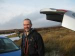
Alistair Macdonald, Rick Legge, Alistair Macdonald, Stephen Fraser, Steven Tuck
We met at Marsden Cricket Club and after the usual formalities and photographs we were off. I’d anticipated a bit of a bottleneck going through the gates approaching Butterlley dam so made sure I got myself forward for the start. It quickly became apparent that, though the start route had been published nobody had actually studied it. This lead to what has been termed the Keystone Cops start to the race and a good deal of hilarity Calls of “which way do we go?” and “We’re all following you” were shouted – I even heard someone say “Follow Mr Tuckle”, I can only guess they sensed that I had some local knowledge. Going through the first gate I found myself in first place! Pity it was at the wrong end of the race and for only 5 seconds. A group passed me then turned to ask me which way they should go when we reached the next gate. It was good to see Mac cheering us on as we crossed the Dam but sadly he was unable to prevent the tidal wave of runners now passing as we hit the obvious trail up the Wessenden Valley.
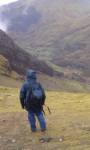
I quickly found my pace and settled in for the long haul as many, many runners passed me by. I was surprised to see people walking where the route steepened briefly at both Little Hey Sike and Leyzing Cloughs and managed to gain a few of the places I had lost. At Wessenden Head reservoir We came off the main Wessenden trail and got our first taste of boggy, tussocky moorland following the ‘Old’ Pennine Way route up to the first road crossing A635 – known locally as the Isle of Skye Road after the pub which was here up until the 1950s when it was demolished either due to a fire or the potential health threat from drainage into the reservoirs.
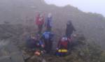
Crossing the road we continued the slog up Black Hill on paving slabs. Straight forward enough but great care had to be taken descending the steep sides of Reap Hill and Dean Clough as my Mudclaws glided effortlessly across the icy surface Blades of Glory style. I didn’t want to risk a fall here so walked down gingerly. Scanning the path carefully for the holes I am prone to fall down. I was soon at the foot of the steep section on the side of Issue Edge which leads to the summit. Everybody seemed to be walking up this section, I’m pretty sure they all thought I was insane as I slowly edged past them in a low gear. It felt great to get to the top where I gave myself a mental high-5 as I tagged the first trig point of the race.
The mist began to thicken but retained the brightness that betrays better things to come. I turned off the Pennine Way and followed a trod across the edge of Sliddens Moss. Here the ground was perfect – soft with a crisp icy shell. A steep and exciting decent lead to Crowden Little Brook. Crossing the brook lead to what is probably an old quarry access road – now a rough trail mined with icy puddles every few yards – 3km of this and I would be at the first checkpoint and refreshments with Jeff. Just before the end of this section I saw my first fellow Peak Bog Man as Alistair passed me. This surprised me as I thought he was already ahead of me. Taking the connoisseurs descent route off the hill I was soon with Jeff who had doing a sterling job of organising supplies. I was busy gulping down some of these supplies when we were joined by Dr Ali. I asked Dr Ali if I could tag along with him for the rest of the race as, from here on, I was on virgin territory – I was glad when he agreed. Fresh supplies stuffed into my rucksack and we were off.
We crossed the second road crossing – A628 Woodhead Pass – and followed a footpath around the top of Torside Reservoir where we encountered the first person to offer us Jelly Babies – strange. Crossing the road, we ran alongside a wall before crossing it and beginning the steep ascent which was to lead us to Lawrence Edge. This is where sticking with Dr Ali began to pay off – he know’s these parts. Definitely not runnable this is a scramble. A scramble that has to be undertaken with the sound of gun fire from neighboring gun club echoing around the rocks. It’s worth it though. Height was gained rapidly and we soon found gradient easing off as we headed to Shining Clough Moss on a moonscape beneath a perfect blue sky.
We joined the Pennine Way just south of Far Moss before leaving it for a trod which took us straight to trig point number 2 at Higher Shelf Stones. This last section was like being on another world. The ground, being covered in ice crystals, sparkled and shone in the bright, clear sunlight. This vision and a surge of endorphins triggered a euphoric rush which lasted for a good ten minutes. It was one of the best running experiences I have ever had.
We set off from the trig point on a good trod which petered out near the top of Crooked Clough. Dr Ali’s route finding and research paid off again. We avoided the descending into the Clough and were soon traversing its eastern edge on another good trod which took us to the Pennine Way. On rapidly tiring legs it wasn’t long before we were at our last road crossing – the A57 Snake Pass – where Jeff was waiting with warm tea and Christmas pudding, a treat I’d been looking forward to the whole race. Reaching this point in my mind was ‘job done’ but I hadn’t any idea how much there was left to do.


We set off on the Pennine Way which was treacherously icy so I was happy when we left it after about 1km at a delta of streams at the bottom of Withins Clough which we were to follow on varying trods to the foot of another steep scramble. Time to dig deep and plug away again. We arrived at a group of stones at the top which I later learned from Bridget were called The Boxing Gloves. After catching our breath we headed off south for our third and final trig point – Kinder. After more jelly babies and a quick bit of banter with the chaps from Woodhead Mountain Rescue we were off on the last stretch.
Not having been on Kinder before I didn’t know what to expect. We headed to the downfall on a good trod before finding the Pennine Way again. The plan from the downfall was to follow a series of stream systems to the Western side of Grindslow Knoll. Again I felt we were on another planet. Running deep inside groughs and stream beds we were almost permanently surrounded by the darkness of eroded peat – the skyline only momentarily visible when we climbed from one to the other. I struggled to imagine a more difficult place to navigate – Dr Ali told me it involved several compass bearings, a small fir tree and a cairn. Even if I’d possessed the neccersay skill and knowledge I was too tired to use it and was happy I had someone to lead my through this maze of frozen blackness. This section was longer than I had imagined. We eventually found ourselves at the top of Grindsbrook Clough. Dr Ali was cross with himself as this meant we were now on the eastern side of Grindslow Knoll, something he’d wanted to avoid. He still managed to expertly navigate us on decent paths back to the route which would lead us down into Edale.
 A wave of emotion and relief swept over us as we spotted the steeple of Edale Parish Church which was followed by hearty congratulations and back slapping. I’ve followed Dr Ali around this race twice before in the car and never imagined that I would ever be able to complete such a challenge and here I was finishing it with the person who’d inspired me, and the sun was shining.
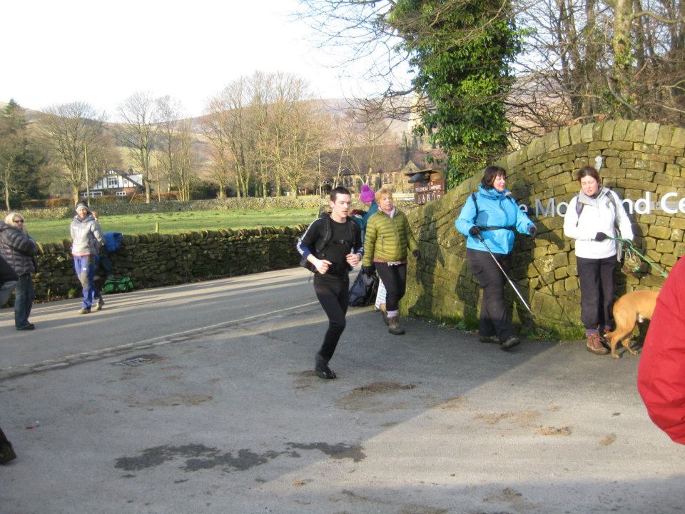
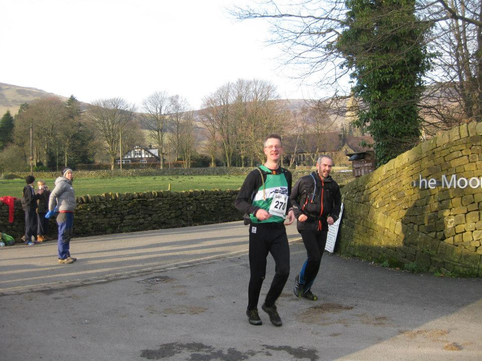
We were soon into the village and running down the road to the finish at Fieldhead Campsite where we were greeted by Jeff, Alistair, Rick and Bridget. We came 118th and 119th finishing in a time of 5h 6m 20s. I was elated and knackered but already looking forward to doing again next year.
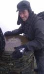
Finish Line photos by Jeff Button.


